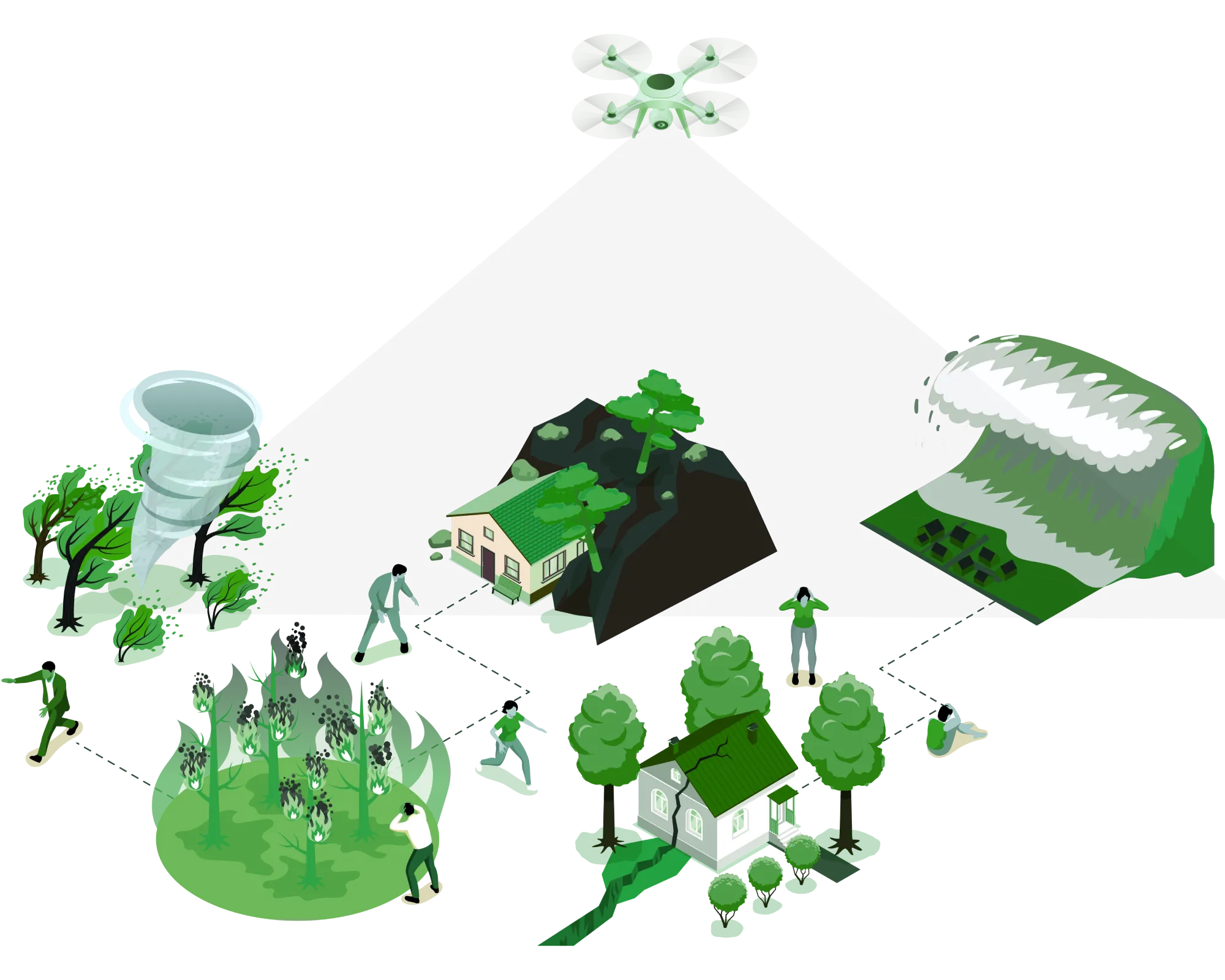
Aerial services for disaster risk management
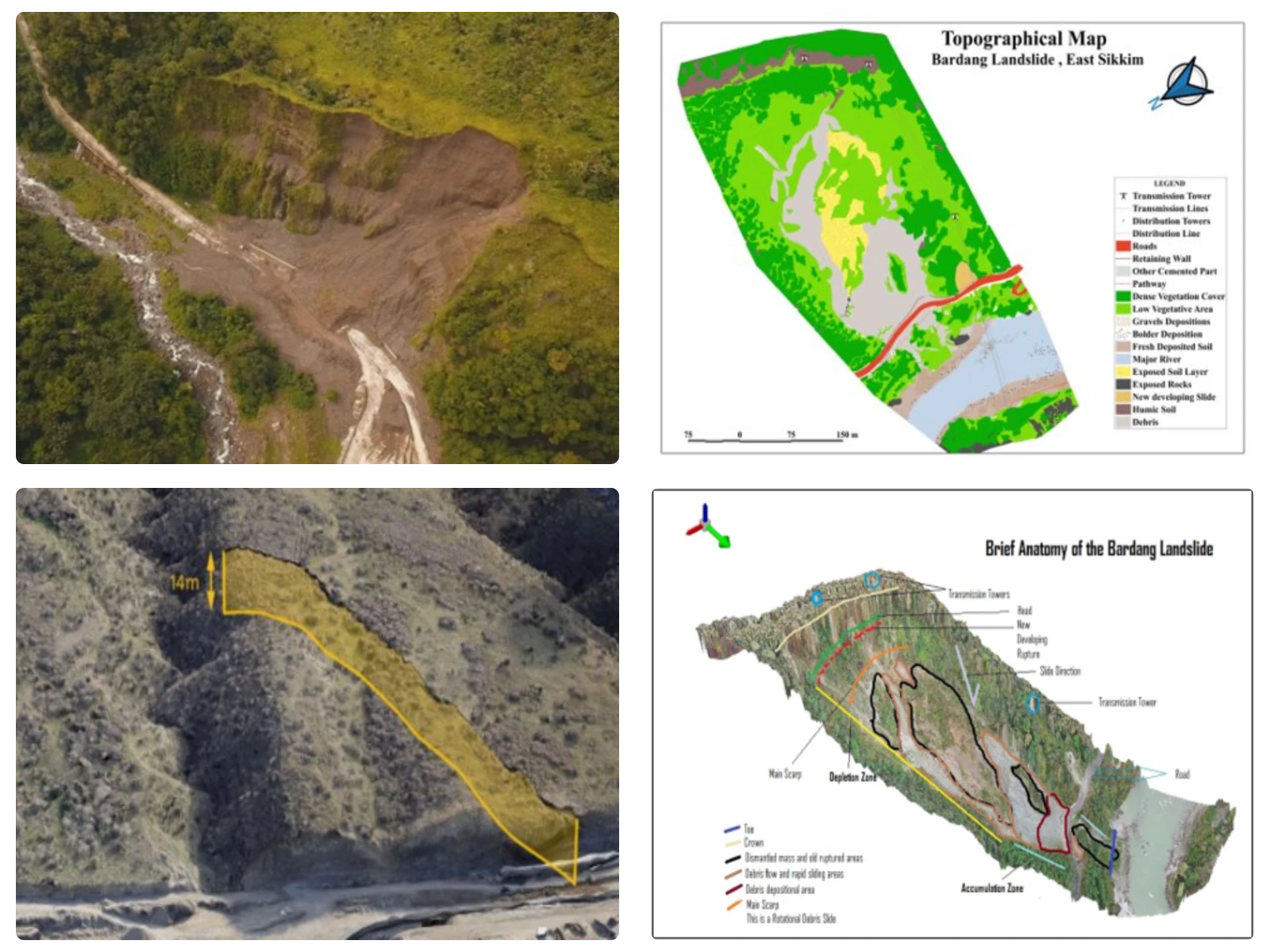
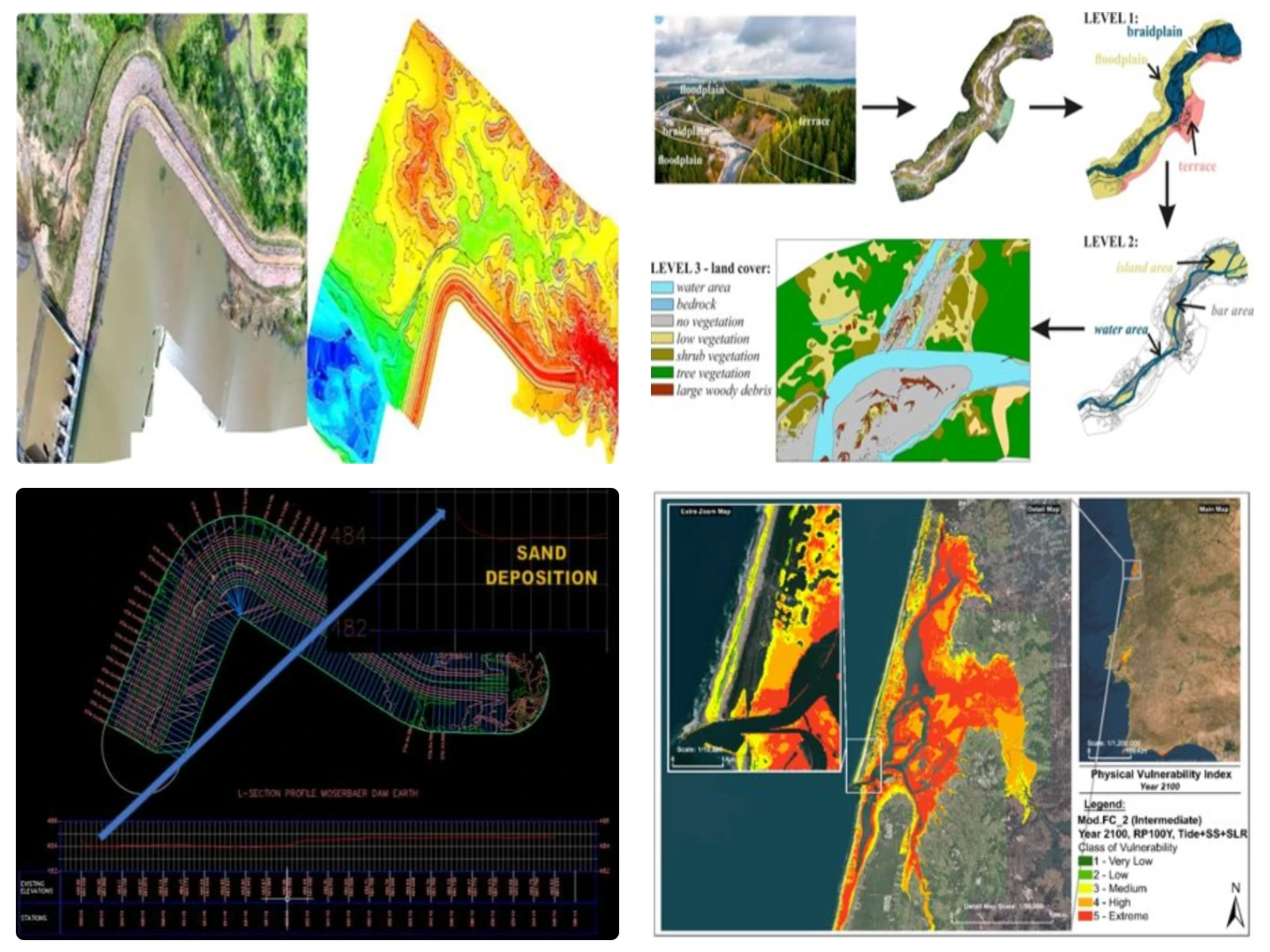
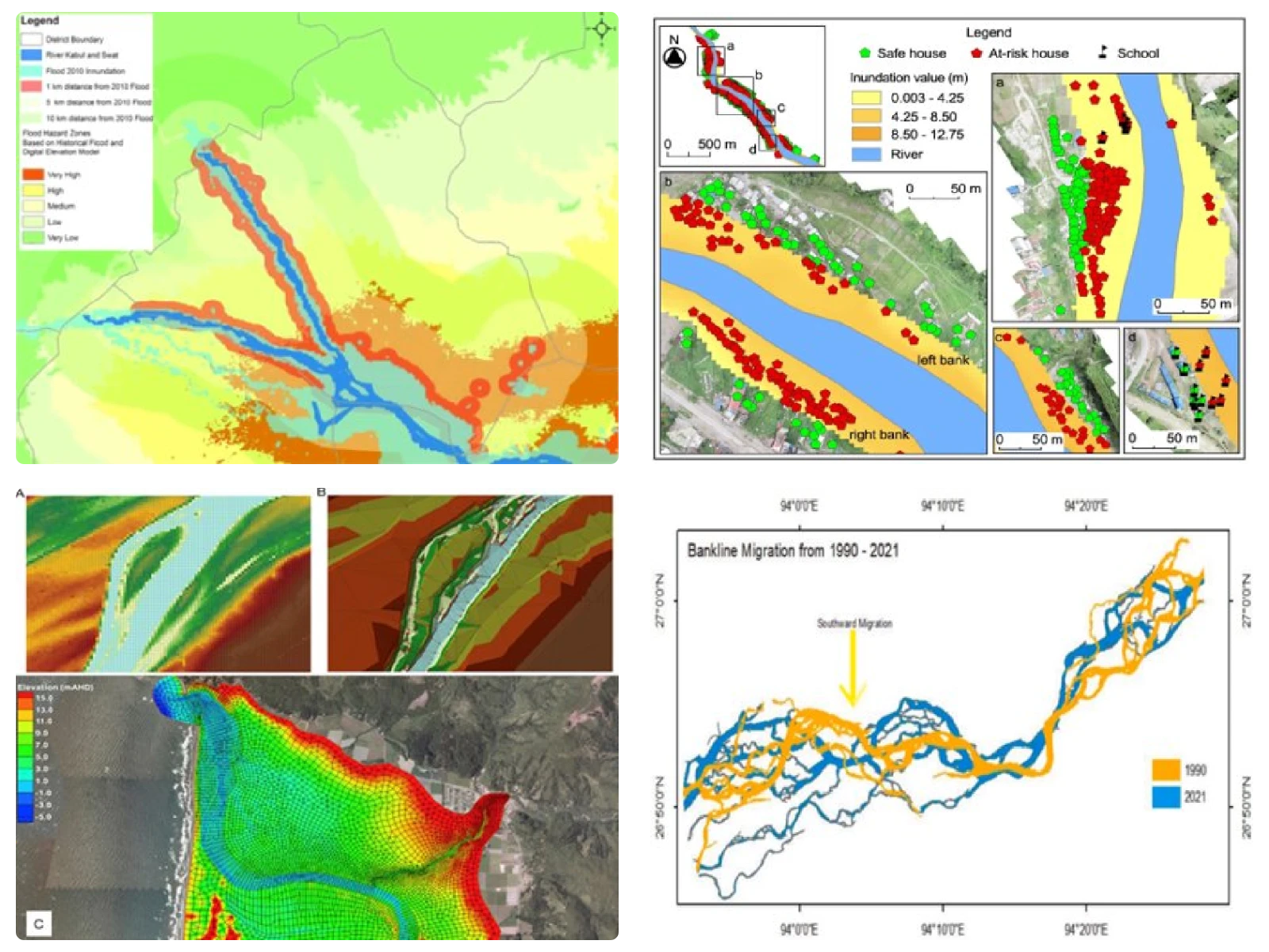
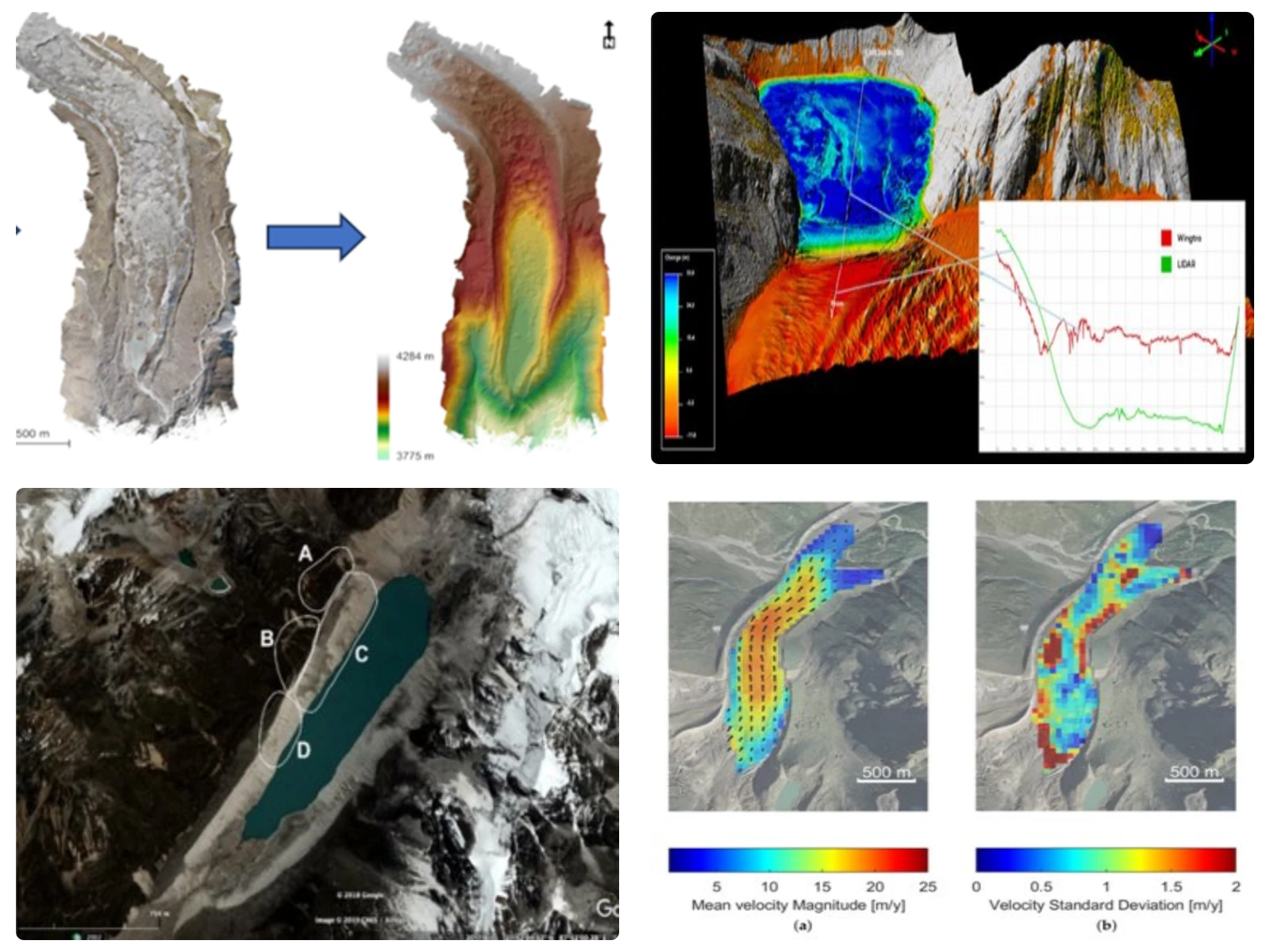
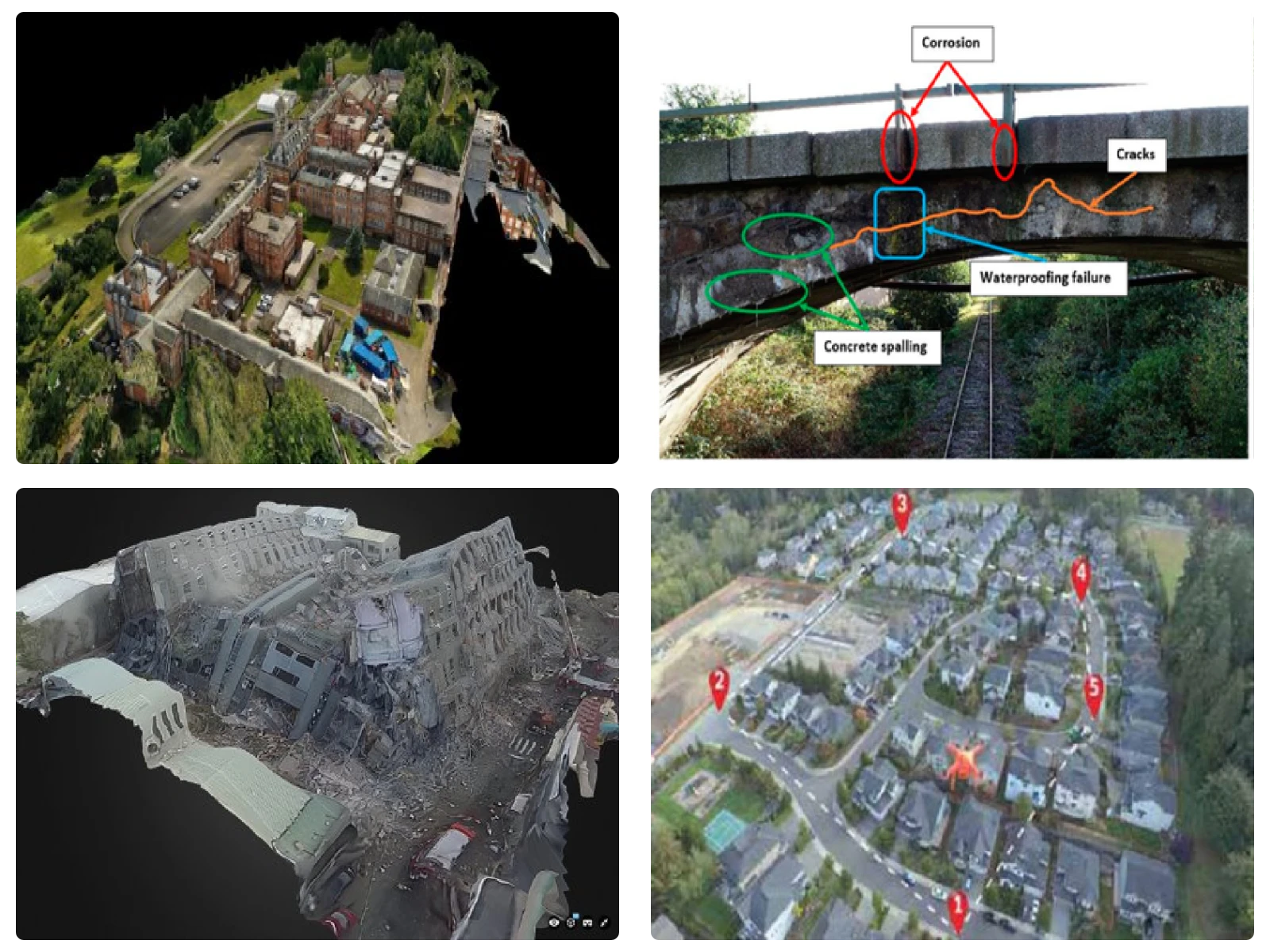
We provide aerial monitoring of disaster-affected areas, asset geotagging, drone-based topographical surveys, flood inundation modelling, glacial lake outburst management, pre-management of cyclones & post-inspection for damage assessment, structural inspection in earthquake-prone areas, and hazardous waste management. Our services include real-time monitoring of flood affected areas, crack analysis for landslides, change detection in coastal zones, mapping of glacier areas, including GLOFs and early warning systems. We also provide various sensors based services in disaster risk management: Photogrammetric UAV, Multispectral Sensor, LiDAR, Hyperspectral Sensors, Thermal Sensors.
Get in Touch