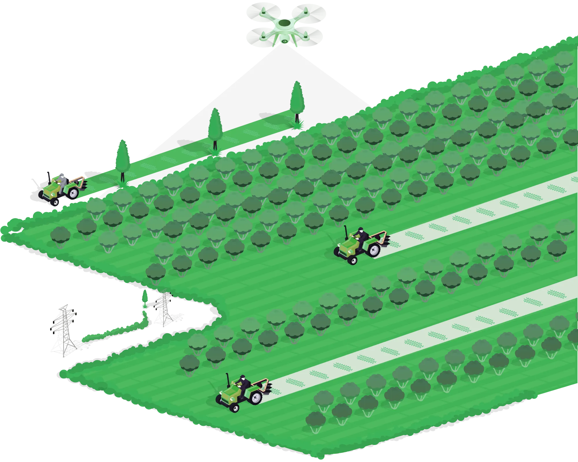
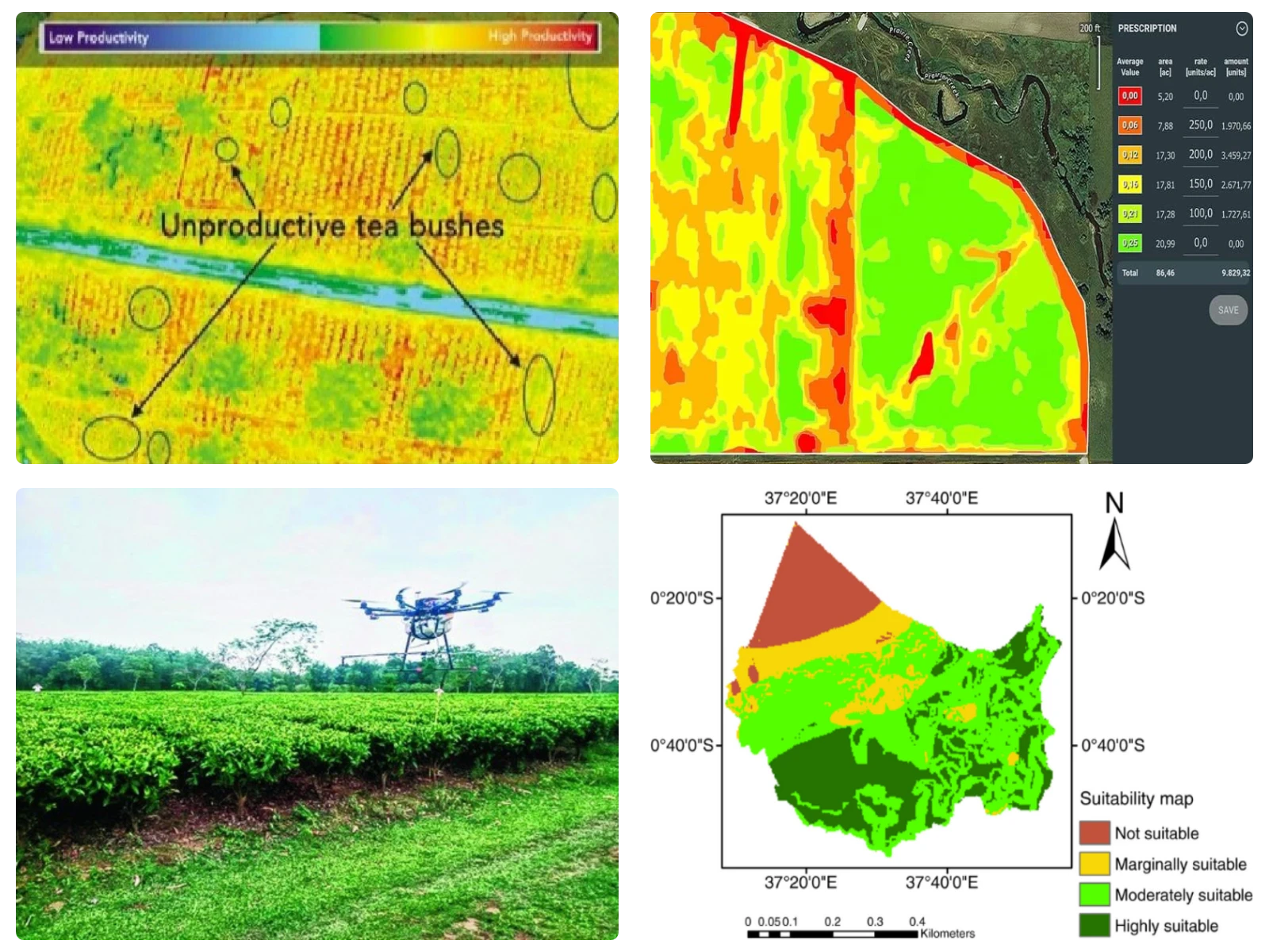
Agriculture

As we face the future, the role of agriculture becomes critical. The global population is projected to reach 9 billion by 2050, necessitating a substantial increase in food production. 
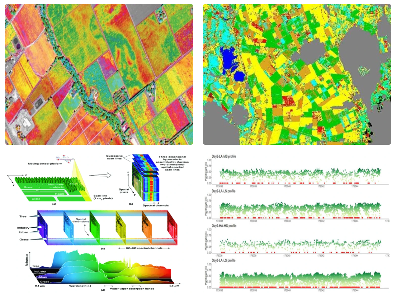
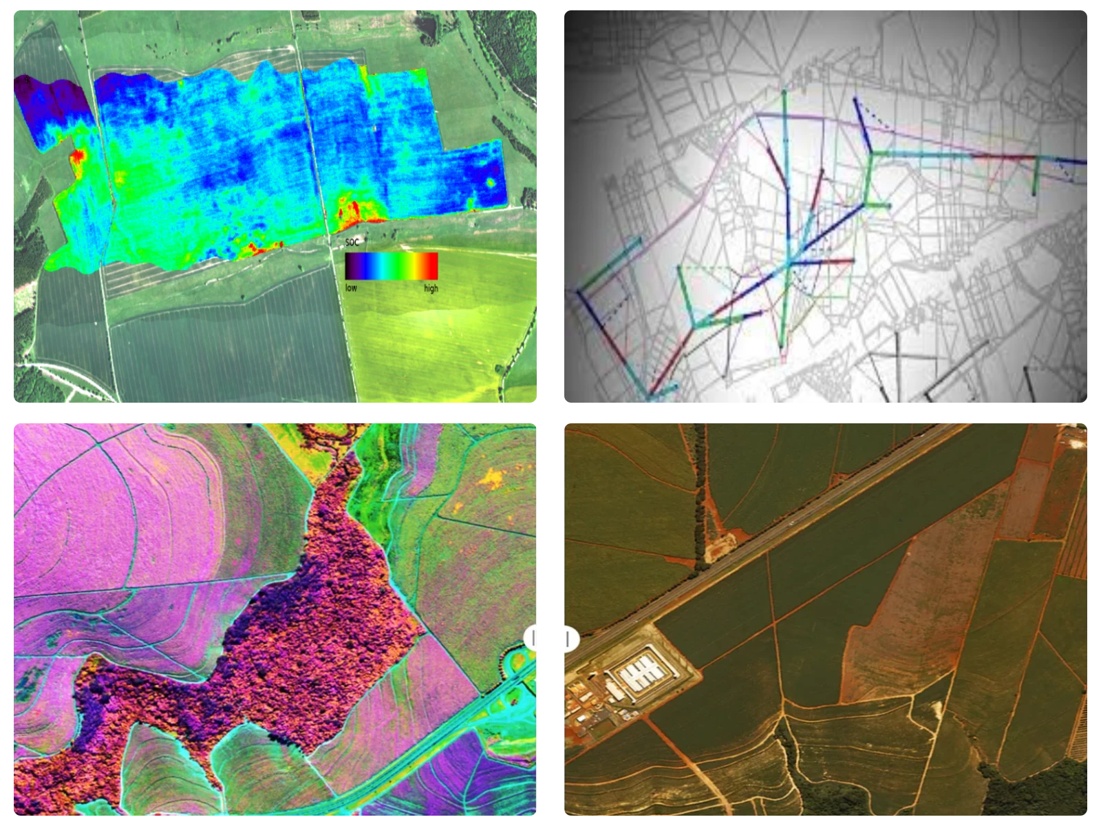
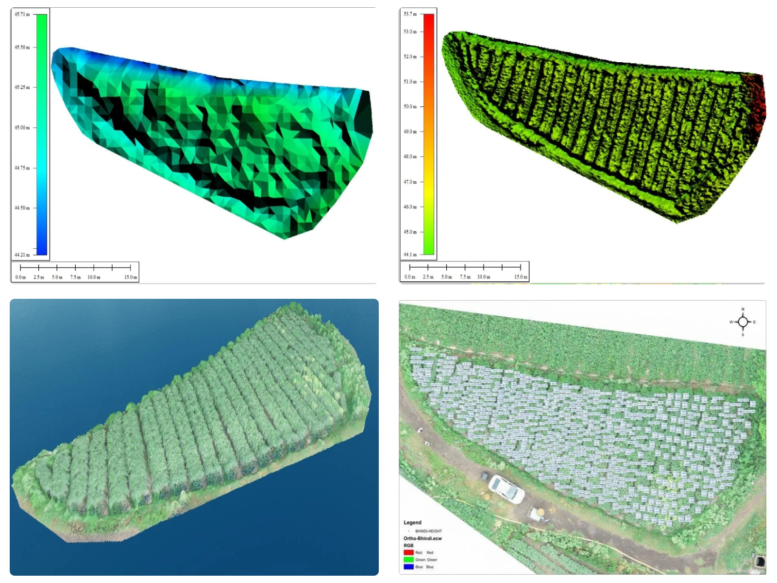
With our state-of-the-art UAV technology and expertise, we enable farmers to gain valuable insights into their crops, optimize resource management, and make data-driven decisions. By harnessing the power of aerial imaging, advanced sensors (Multispectral, Hyperspectral, LiDAR & Thermal), and cutting-edge analytics, we offer a suite of services that address the key challenges faced by modern farmers.

Get in Touch
Coal and Mine Survey
Banner background image right Banner background image bottom
Surveying Mapping Survey

Surveying & Mapping

  • Drone Survey
  • DGPS Survey
  • Tographical survey
  • Boundary demarcation
  • Airborne LiDARg
  • Terrestrial LiDAR
  • Cadastral Superimposition
  • Crop Identification & Classification
  • Landuse/ Landcover mapping
  • Crop & Plantation Monitoring

Analytical Services

  • Crop loss assessment
  • NDVI, NDWI, SAVI & LAI
  • Crop Health Monitoring
  • Identification of Pests and Disease Infestation
  • Crop Height Estimation
  • Canopy cover assessment
  • Above Ground Biomass Analysis
  • Crop Yield Estimation
  • Carbon Sequestration Estimation
Inspection Monitoring Survey
Project Progress monitoring Survey

DPR Services

  • Irrigation Management
  • Drainage System Design
  • Watershed Management
  • Soil erosion and land management

BLUEHAWK

BlueHawk is an AI-powered Enterprise Drone & GIS based web Platform which transforms aerial data into actionable insights. BlueHawk helps enterprises at every step from data acquisition to data-driven action. BlueHawk provides a digital platform for a complete life cycle of a project i.e, survey & mapping, monitoring, inspection, surveillance, O&M services and perform various analytics With the help of our platform, we can develop & maintain Digital library of Agriculture, which includes

  • Automated Mission Planning
  • Real-time data synchronization to cloud
  • Drone/Lidar data visualization
  • 3-D data visualization
  • High quality 4k Video playback
  • Assets Geo-tagged
  • Fully Automated Maintenance and Planning
  • Yield estimation
  • Change Detection
  • Role based access control
  • Automatic Report Generation

Our Clientele

Contact Us